
-
×
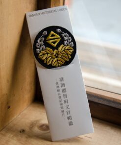 臺灣歷史徽記-臺灣文官帽徽1895-1945(燙貼繡片)
1 × NT$200
臺灣歷史徽記-臺灣文官帽徽1895-1945(燙貼繡片)
1 × NT$200 -
×
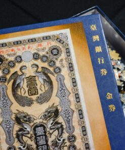 臺灣銀行券金券復刻拼圖(520片)
1 × NT$499
臺灣銀行券金券復刻拼圖(520片)
1 × NT$499 -
×
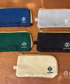 日本時代市徽方形萬物袋(共5款) - 臺灣
1 × NT$180
日本時代市徽方形萬物袋(共5款) - 臺灣
1 × NT$180 -
×
日本時代市徽方形萬物袋(共5款) - 高雄
1 × NT$180
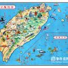

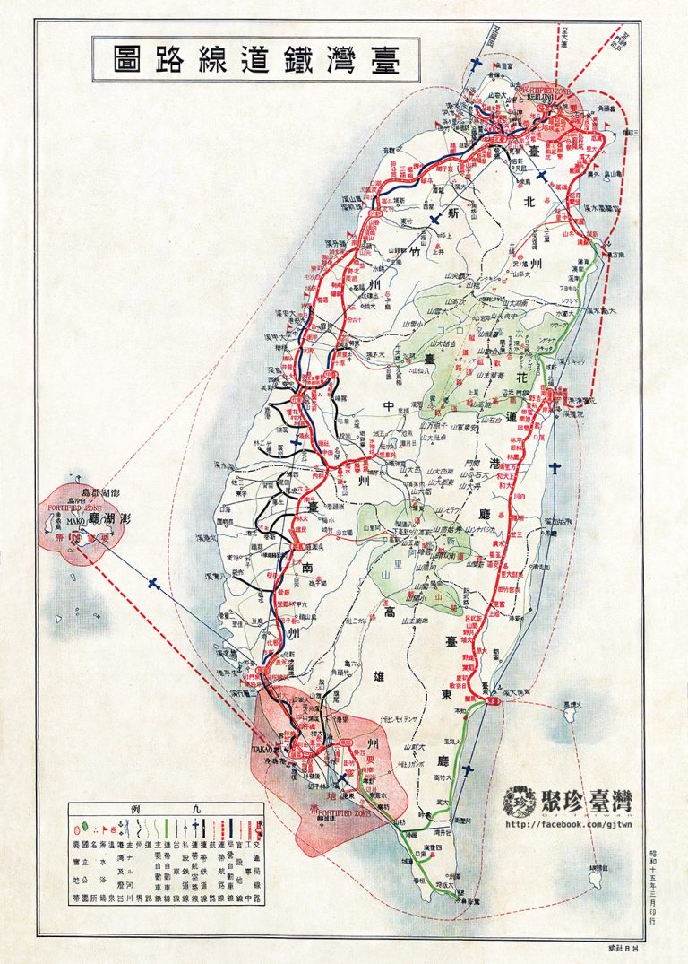
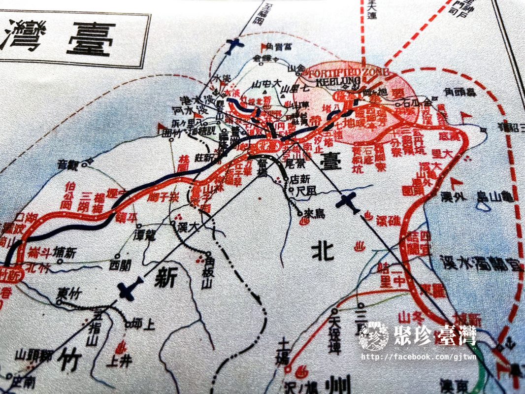
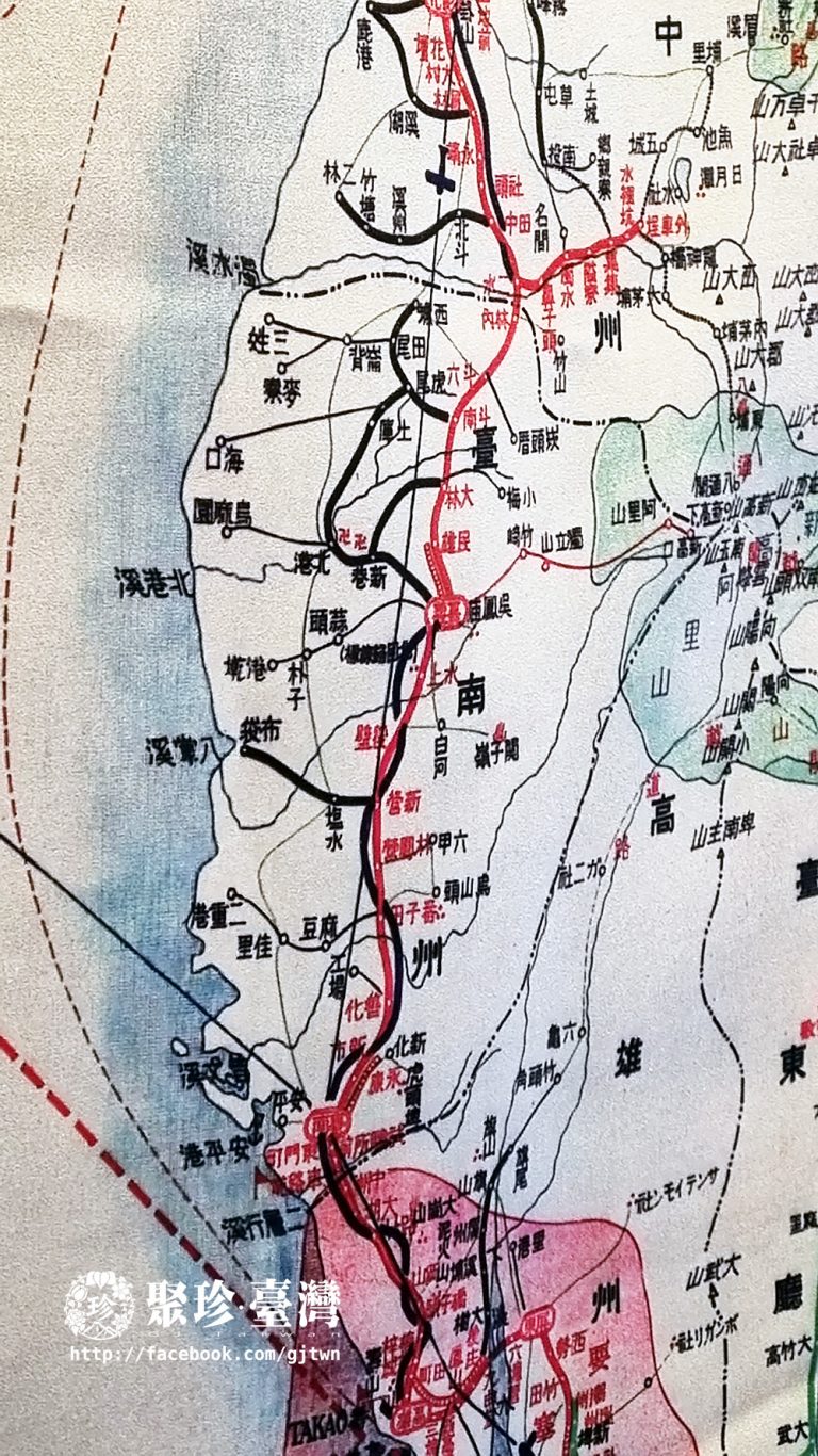
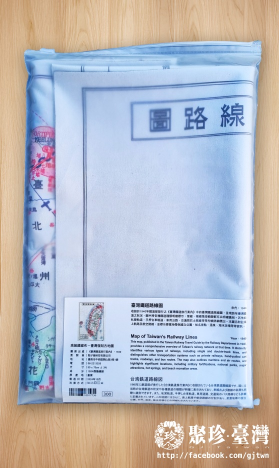

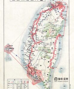
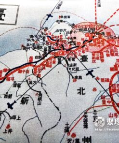
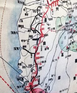
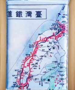
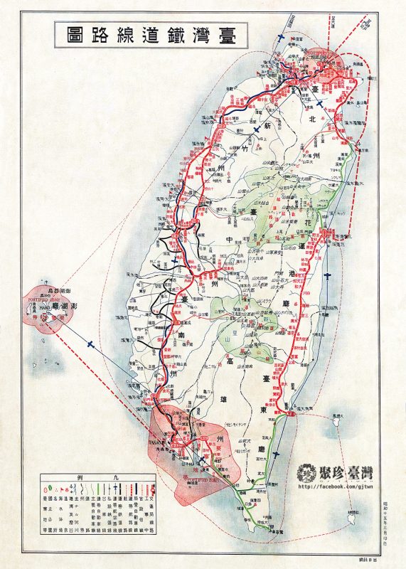
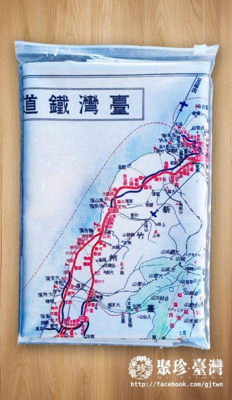
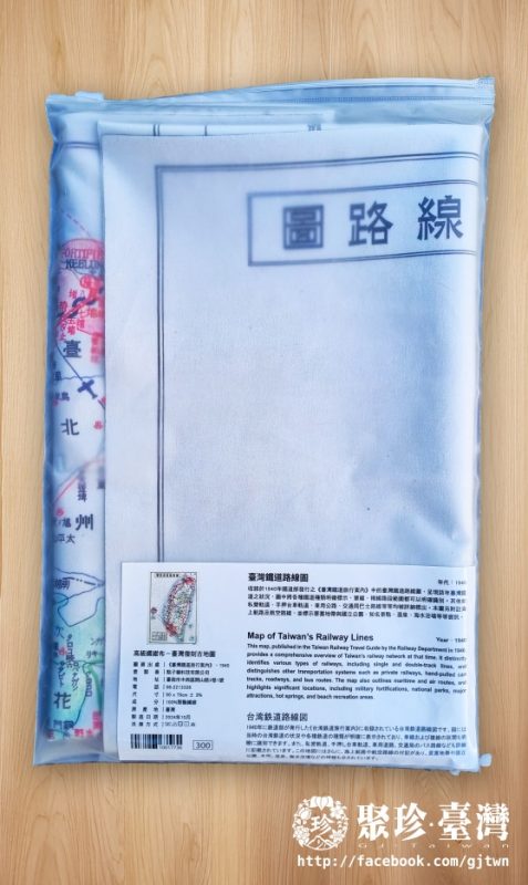
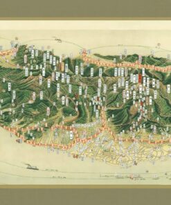
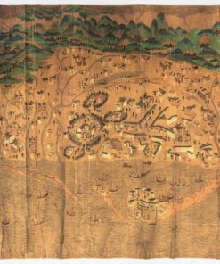
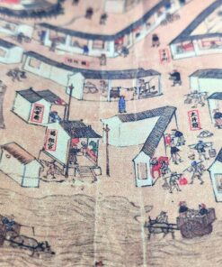
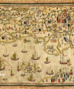
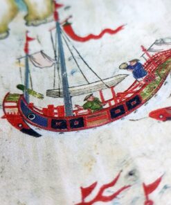
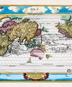
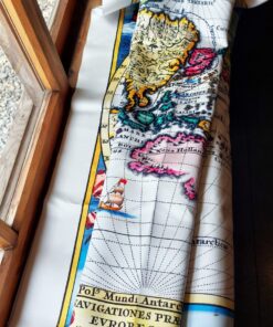
臺灣鐵道路線圖(1940) 地圖布

內容簡介
收錄於1940年鐵道部發行之《臺灣鐵道旅行案內》中的臺灣鐵道路線圖,呈現該年臺灣鐵道之情況,圖中將各種鐵道種類明確標示,單線、複線路段範圍都可以明確識別。
其他如私營軌道、手押台車軌道、車用公路、交通局巴士路線等等均被詳細標出。本圖另附註海上航路及航空路線,並標示要塞地帶與國立公園、知名景點、溫泉、海水浴場等等資訊。
Map of Taiwan’s Railway Lines
This map, published in the Taiwan Railway Travel Guide by the Railway Department in 1940, provides a comprehensive overview of Taiwan’s Railway network at that time.
It distinctly odentifies various types of railways, including single and double-track lines, and tracks, roadways, and distinguishes other transportation systems such as private railways, hand-pulled cart tracks, roadways, and bus routes. The map also outlines maritime and air routes, and highlights sighnificant locations, including military fortfications, national parks, major attractions, hot springs, and beach recreation areas.
臺灣鐵道路線圖
年代:1940年
Map of Taiwan’s Railway Lines
台湾鉄道路線図
收錄於 《臺灣鐵道旅行案內》(1940)
This map was originally included in Taiwan Railway Travel Guide published in 1940.
収録: 《台湾鉄道旅行案内》(1940)
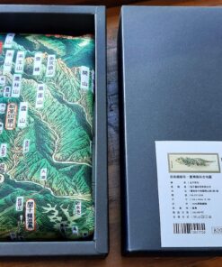
產地:臺灣
製造日期:2024-10
材質:100%聚酯纖維
尺寸:50 x 70cm ± 3%
相關商品
已售完
地圖布
NT$820
已售完
地圖布
NT$400
已售完
地圖布
NT$820
已售完
地圖布
NT$400
已售完
地圖布
NT$999